![Nantahala and Cullasaja Gorges [nantahala National Forest]](https://images.eurobuch.ch/buch/cover/OTc4MTU2Njk1MzEyMjtodHRwczovL3d3dy5ib29rc3BvdC5ubC9pbWFnZXMvYWN0aXZlL2NhcnJvdXNlbC9mdWxsc2l6ZS85NzgxNTY2OTUzMTIyX2Zyb250LmpwZw%3D%3D.jpg)
ISBN: 9781566953122
Het boek 'Nantahala and Cullasaja Gorges [nantahala National Forest]' van National Geographic Maps - Trails Illust koop je bij bookspot.nl, nu voor €12.99! Engelse Boeken Reizen… Plus…
| BookSpot.nl |

ISBN: 9781566953122
Sheet map, [PU: National Geographic Maps], Coverage includes Nantahala National Forest - Nantahala & Cullasaja Gorges area. Towns: Franklin, Sylva, Highlands, Cashiers. Wilderness Areas: … Plus…
| BookDepository.com Frais d'envoiVersandkostenfrei. (EUR 0.00) Details... |

ISBN: 9781566953122
Nantahala and Cullasaja Gorges, Nantahala National Forest Nantahala-and-Cullasaja-Gorges-Nantahala-National-Forest~~National-Geographic-Maps Maps>NC SC>NC SC Other Format, National Geogra… Plus…
| BarnesandNoble.com new Frais d'envoizzgl. Versandkosten., Livraison non-comprise Details... |

2012, ISBN: 9781566953122
Trails Illustrated Other Rec. Areas, Karte/Globus, Karte (gefalzt), 2020th ed. [PU: National Geographic Maps], National Geographic Maps, 2012
| lehmanns.de Frais d'envoiVersand in 7-10 Tagen. (EUR 0.00) Details... |
2012, ISBN: 9781566953122
Trails Illustrated Other Rec. Areas, Karte/Globus, Karte (gefalzt), 2010th ed. [PU: National Geographic Maps], National Geographic Maps, 2012
| lehmanns.de Frais d'envoiVersand in 7-10 Tagen. (EUR 0.00) Details... |

![Nantahala and Cullasaja Gorges [nantahala National Forest]](https://www.bookspot.nl/images/active/carrousel/fullsize/9781566953122_front.jpg)
ISBN: 9781566953122
Het boek 'Nantahala and Cullasaja Gorges [nantahala National Forest]' van National Geographic Maps - Trails Illust koop je bij bookspot.nl, nu voor €12.99! Engelse Boeken Reizen… Plus…


ISBN: 9781566953122
Sheet map, [PU: National Geographic Maps], Coverage includes Nantahala National Forest - Nantahala & Cullasaja Gorges area. Towns: Franklin, Sylva, Highlands, Cashiers. Wilderness Areas: … Plus…
ISBN: 9781566953122
Nantahala and Cullasaja Gorges, Nantahala National Forest Nantahala-and-Cullasaja-Gorges-Nantahala-National-Forest~~National-Geographic-Maps Maps>NC SC>NC SC Other Format, National Geogra… Plus…
2012, ISBN: 9781566953122
Trails Illustrated Other Rec. Areas, Karte/Globus, Karte (gefalzt), 2020th ed. [PU: National Geographic Maps], National Geographic Maps, 2012
2012, ISBN: 9781566953122
Trails Illustrated Other Rec. Areas, Karte/Globus, Karte (gefalzt), 2010th ed. [PU: National Geographic Maps], National Geographic Maps, 2012
Données bibliographiques du meilleur livre correspondant

| Auteur: | |
| Titre: | |
| ISBN: |
• Waterproof • Tear-Resistant • Topographic Map
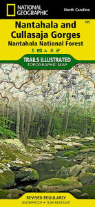
National Geographic's Trail Illustrated map of Natahala and Cullasaja Gorges offers unparalleled detail for outdoor enthusiasts exploring the eastern half of Natahala National Forest. Expertly researched and created in partnership with the U.S. Forest Service and others, this map includes valuable trail and safety information as well as activity guides to help you select the most suitable location to explore according to your needs and interests. The maps also includes trail charts, broken down by district, listing each trail's mileage and designated use. Trails on the map are also color coded according designated use.
Special detail is given to the Batram, Appalachian, Foothills and Mountains-to-Sea Trails, which are all highlighted on the map. The map base includes contour lines and elevations. Among the recreation features clearly marked on the map are river and whitewater access points, swimming areas, waterfalls, fishing areas, overlooks, lookout towers, and campgrounds. Scenic byways are also clearly marked, for those who which to explore the area by car.
Every Trails Illustrated map is printed on "Backcountry Tough" waterproof, tear-resistant paper. A full UTM grid is printed on the map to aid with GPS navigation.
Other features found on this map include: Chattahoochee National Forest, Cold Mountain, Cowee Mountains, Great Smoky Mountains, Middle Prong Wilderness, Nantahala Mountains, Nantahala National Forest, Pisgah National Forest, Rabun Bald, Sassafras Mountain, Shining Rock Wilderness, Southern Nantahala Wilderness, Sumter National Forest, Waynesville.
Map Scale = 1:70,000Sheet Size = 25.5" x 37.75"Folded Size = 4.25" x 9.25"Informations détaillées sur le livre - Nantahala And Cullasaja Gorges, Nantahala National Forest
EAN (ISBN-13): 9781566953122
ISBN (ISBN-10): 156695312X
Livre de poche
Date de parution: 2010
Editeur: National Geographic Maps
2 Pages
Poids: 0,077 kg
Langue: eng/Englisch
Livre dans la base de données depuis 2012-03-18T00:57:21+01:00 (Zurich)
Page de détail modifiée en dernier sur 2022-03-25T22:24:04+01:00 (Zurich)
ISBN/EAN: 9781566953122
ISBN - Autres types d'écriture:
1-56695-312-X, 978-1-56695-312-2
Autres types d'écriture et termes associés:
Auteur du livre: national geographic maps
Titre du livre: gorges
Données de l'éditeur
Titre: Nantahala / Cullasaja Gorges - National Geographic Trails Illustrated USA Südosten
Editeur: National Geographic Maps
Langue: Anglais
9,99 € (DE)
10,30 € (AT)
Not available (reason unspecified)
CB; GEF; Karten, Globen / Reisen/Karten, Stadtpläne, Atlanten/Nordamerika, Mittelamerika; Landkarten und Atlanten; Nordamerika (USA und Kanada)
< pour archiver...