
ISBN: 9781566953863
Sheet map, [PU: National Geographic Maps], This Trails Illustrated map for Glacier Bay National Park, Glacier Bay National Preserve, and surrounding area and surrounding area in Alaska's … Plus…
| BookDepository.com Frais d'envoiVersandkostenfrei. (EUR 0.00) Details... |

Glacier Bay National Park: National Geographic Trails Illustrated Alaska: Trails Illustrated National Parks (National Geographic Trails Illustrated Map, Band 255) - nouveau livre
2011, ISBN: 9781566953863
National Geographic Maps, Landkarte, Auflage: 014, 1 Seiten, Publiziert: 2011-01-01T00:00:01Z, Produktgruppe: Buch, Hersteller-Nr.: TI00000255, 0.09 kg, Freizeit, Haus & Garten, Kategorie… Plus…
| amazon.de Frais d'envoiDie angegebenen Versandkosten können von den tatsächlichen Kosten abweichen. (EUR 3.00) Details... |
Glacier Bay National Park: National Geographic Trails Illustrated Alaska: Trails Illustrated National Parks (National Geographic Trails Illustrated Map, Band 255) - nouveau livre
2011, ISBN: 9781566953863
National Geographic Maps, Landkarte, Auflage: 014, 1 Seiten, Publiziert: 2011-01-01T00:00:01Z, Produktgruppe: Buch, Hersteller-Nr.: TI00000255, 0.09 kg, Freizeit, Haus & Garten, Kategorie… Plus…
| amazon.de TheGlobalBuyer Frais d'envoiGewöhnlich versandfertig in 3 bis 4 Tagen. Die angegebenen Versandkosten können von den tatsächlichen Kosten abweichen. (EUR 3.00) Details... |

Glacier Bay National Park: National Geographic Trails Illustrated Alaska: Trails Illustrated National Parks (National Geographic Trails Illustrated Map, Band 255) - livre d'occasion
2011, ISBN: 9781566953863
National Geographic Maps, Landkarte, Auflage: 014, 1 Seiten, Publiziert: 2011-01-01T00:00:01Z, Produktgruppe: Buch, Hersteller-Nr.: TI00000255, 0.2 kg, Freizeit, Haus & Garten, Kategorien… Plus…
| amazon.de ErgodeBooks Ships From USA Gut Frais d'envoiAuf Lager. Die angegebenen Versandkosten können von den tatsächlichen Kosten abweichen. (EUR 3.00) Details... |

2012, ISBN: 9781566953863
Trails Illustrated National Parks, Karte/Globus, Karte (gefalzt), 2019th ed. [PU: National Geographic Maps], National Geographic Maps, 2012
| lehmanns.de Frais d'envoiVersand in 7-10 Tagen. (EUR 0.00) Details... |


ISBN: 9781566953863
Sheet map, [PU: National Geographic Maps], This Trails Illustrated map for Glacier Bay National Park, Glacier Bay National Preserve, and surrounding area and surrounding area in Alaska's … Plus…


National Geographic Maps:
Glacier Bay National Park: National Geographic Trails Illustrated Alaska: Trails Illustrated National Parks (National Geographic Trails Illustrated Map, Band 255) - nouveau livre2011, ISBN: 9781566953863
National Geographic Maps, Landkarte, Auflage: 014, 1 Seiten, Publiziert: 2011-01-01T00:00:01Z, Produktgruppe: Buch, Hersteller-Nr.: TI00000255, 0.09 kg, Freizeit, Haus & Garten, Kategorie… Plus…
Glacier Bay National Park: National Geographic Trails Illustrated Alaska: Trails Illustrated National Parks (National Geographic Trails Illustrated Map, Band 255) - nouveau livre
2011
ISBN: 9781566953863
National Geographic Maps, Landkarte, Auflage: 014, 1 Seiten, Publiziert: 2011-01-01T00:00:01Z, Produktgruppe: Buch, Hersteller-Nr.: TI00000255, 0.09 kg, Freizeit, Haus & Garten, Kategorie… Plus…

Glacier Bay National Park: National Geographic Trails Illustrated Alaska: Trails Illustrated National Parks (National Geographic Trails Illustrated Map, Band 255) - livre d'occasion
2011, ISBN: 9781566953863
National Geographic Maps, Landkarte, Auflage: 014, 1 Seiten, Publiziert: 2011-01-01T00:00:01Z, Produktgruppe: Buch, Hersteller-Nr.: TI00000255, 0.2 kg, Freizeit, Haus & Garten, Kategorien… Plus…
2012, ISBN: 9781566953863
Trails Illustrated National Parks, Karte/Globus, Karte (gefalzt), 2019th ed. [PU: National Geographic Maps], National Geographic Maps, 2012
Données bibliographiques du meilleur livre correspondant

| Auteur: | |
| Titre: | |
| ISBN: |
• Waterproof • Tear-Resistant • Topographic Map
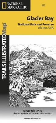
National Geographic’s Trails Illustrated map of Glacier Bay National Park and Preserve in Alaska's panhandle is perfect for hiking, camping, boating, paddling, and wildlife viewing in this scenic, rugged frontier. Created in partnership with local land management agencies, this expertly researched map delivers unmatched detail and helpful information for experienced outdoor enthusiasts and casual visitors alike. Some of the key areas of interest covered include Glacier Bay Wilderness, portions of Tongass National Forest, Chicagof Island, Endicott River Wilderness, Chilkat State Park, Chilkat Islands, Sullivan Island State Marine Park, Pleasant Island, Lemesurier Island, Inian Islands, and Tatshenshini Alsek Park. Waterways include the Gulf of Alaska; Glacier, Tituya, Berners, Tidal, Scidmore, and Taylor bays; Cross Sound; Icy Strait; Lynn Canal; North Passage; and Geikie, Muir, Tarr, Chilkoot, Chilkat, Wachusett, Queen, and Rendu inlets. The print version of this map contains detailed insets of Tarr and Johns Hopkins inlets, Gustavus, and Lamplugh Glacier.
Transportation in Glacier Bay’s wilderness can be challenging, but you’ll find the information you need on this map with an accurate road network, ferries, boat ramps, harbors and anchorages, seaplane bases, seaplane anchorages, airports, and landing strips. In addition to contour lines, shaded relief, and summit elevations, this map highlights the many waterways with bathymetry, depths, and navigational aids. A handy distance chart will help you plan your outings. Many recreation features and facilities are noted as well, including hiking trails, campgrounds, picnic areas, rental cabins, lodging, boat fueling stations, ranger stations, and scenic byways.
Every Trails Illustrated map is printed on "Backcountry Tough" waterproof, tear-resistant paper. A full UTM grid is printed on the map to aid with GPS navigation.
Other features found on this map include: Alsek Glacier, Alsek River, Brady Glacier, Cape Fairweather, Cape Spencer, Carroll Glacier, Casement Glacier, Chilkat Lake, Chilkat Range, Chilkat River, Cross Sound, Endicott River Wilderness, Fairweather Range, Glacier Bay, Glacier Bay National Park, Glacier Bay National Preserve, Grand Plateau Glacier, Icy Point, Icy Strait, Johns Hopkins Inlet, La Chaussee Spit, Muir Glacier, Muir Inlet, Novatak Glacier, Palma Bay, Plateau Glacier, Pleasant Island, Pleasant/Lemusurier/Inian Islands Wilderness, Tarr Inlet, Tongass National Forest.
Map Scale = 1:100,000 & 1:240,000Sheet Size = 37.75" x 25.5"Folded Size = 4.2Informations détaillées sur le livre - Glacier Bay National Park: National Geographic Trails Illustrated Alaska: Trails Illustrated National Parks (National Geographic Trails Illustrated Map, Band 255)
EAN (ISBN-13): 9781566953863
ISBN (ISBN-10): 1566953863
Date de parution: 2009
Editeur: National Geographic Maps
2 Pages
Poids: 0,181 kg
Langue: eng/Englisch
Livre dans la base de données depuis 2010-08-17T17:09:03+02:00 (Zurich)
Page de détail modifiée en dernier sur 2023-08-25T21:21:52+02:00 (Zurich)
ISBN/EAN: 9781566953863
ISBN - Autres types d'écriture:
1-56695-386-3, 978-1-56695-386-3
Autres types d'écriture et termes associés:
Auteur du livre: geographic
Titre du livre: 255, geographic geographic, looking for alaska, glacier bay
Données de l'éditeur
Titre: Glacier Bay National Park - National Geographic Trails Illustrated Alaska
Editeur: National Geographic Maps
Langue: Anglais
9,99 € (DE)
10,30 € (AT)
Not available (reason unspecified)
CB; GEF; Karten, Globen / Reisen/Karten, Stadtpläne, Atlanten/Nordamerika, Mittelamerika; Landkarten und Atlanten; Nordamerika (USA und Kanada)
Autres livres qui pourraient ressembler au livre recherché:
Dernier livre similaire:
0749717009905 Acadia National Park, ME: National Geographic Trails Illustrated USA Nordosten: Outdoor Recreation Map. Isle Au Haut, Mount Desert Island, and ... Geographic Trails Illustrated Map, Band 212) (National Geographic Maps)
- 0749717009905 Acadia National Park, ME: National Geographic Trails Illustrated USA Nordosten: Outdoor Recreation Map. Isle Au Haut, Mount Desert Island, and ... Geographic Trails Illustrated Map, Band 212) (National Geographic Maps)
- 0749717002630 Grand Canyon West, AZ: NATIONAL GEOGRAPHIC Trails Illustrated National Parks: Outdoor Recreation Map. Grand Canyon National Park Arizona, USA (National Geographic Trails Illustrated Map, Band 263) (National Geographic Maps)
- 9781566952897 Big Bend National Park Trails Illustrated Author (National Geographic Maps)
- Durango, Cortez (National Geographic Trails Illustrated Map) by National Geographic Maps - Trails Illustrated (2007-01-01) (National Geographic Maps - Trails Illustrated)
< pour archiver...