Eagle/Avon, Colorado, USA Outdoor Recreation Map National Geographic Maps Created by
- nouveau livreISBN: 9781566953948
• Waterproof • Tear-Resistant • Topographic MapNational Geographic's Trails Illustrated map of Eagle and Avon is the ultimate tool for exploring this region in the heart of… Plus…
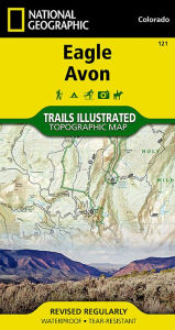
• Waterproof • Tear-Resistant • Topographic MapNational Geographic's Trails Illustrated map of Eagle and Avon is the ultimate tool for exploring this region in the heart of the Colorado Rockies. Designed for experienced and novice outdoor enthusiasts alike, this expertly researched map was created in partnership with the U.S. Forest Service, Bureau of Land Management and others and delivers unparalleled detail of the area. Coverage includes Holy Cross Wilderness, White River National Forest, Beaver Creek Ski Area, Bocco and Hardscrabble Mountains, Eagle River, Gypsum Ponds State Wildlife Area and Sylvan Lake State Park.Explore the area by following along clearly mapped trails, marked for hiking or motorized use. Road and mountain bike trails are clearly labeled, as are winter trails. Some other recreation features are alpine and cross-country ski areas, campgrounds, 10th Mountain Division trails and huts, fishing holes, boat launch points and wildlife viewing areas. To aid in your navigation, the map includes contour lines, elevations, labeled peaks, summits and passes, water features, numbered Forest Service and BLM roads, areas of wooded cover, selected waypoints and clear boundaries between different land management agencies. Also provided are wilderness regulations, survival tips, Leave no Trace guidelines and essential contact information.Every Trails Illustrated map is printed on Backcountry Tough waterproof, tear-resistant paper. A full UTM grid is printed on the map to aid with GPS navigation.Other features found on this map include: Hardscrabble Mountain, Holy Cross Wilderness, White River National Forest.Map Scale = 1:40,680Sheet Size = 22 x 32Folded Size = 4 x 7.5 Trade Books>Hardcover>Undefined>Undefined>Undefined, National Geographic Maps Core >2<
| | BarnesandNoble.comnew in stock. Frais d'envoizzgl. Versandkosten., Livraison non-comprise Details... |
(*) Livre non disponible signifie que le livre est actuellement pas disponible à l'une des plates-formes associées nous recherche.

EXEMPLE
National Geographic Maps:Eagle/avon: Trails Illustrated (Sheet map)
- nouveau livre 2019, ISBN: 1566953944
[EAN: 9781566953948], Neubuch, [PU: National Geographic Maps, United States], Language: English. Brand new Book. - Waterproof - Tear-Resistant - Topographic MapNational Geographic's Trail… Plus…
[EAN: 9781566953948], Neubuch, [PU: National Geographic Maps, United States], Language: English. Brand new Book. - Waterproof - Tear-Resistant - Topographic MapNational Geographic's Trails Illustrated map of Eagle and Avon is the ultimate tool for exploring this region in the heart of the Colorado Rockies. Designed for experienced and novice outdoor enthusiasts alike, this expertly researched map was created in partnership with the U.S. Forest Service, Bureau of Land Management and others and delivers unparalleled detail of the area. Coverage includes Holy Cross Wilderness, White River National Forest, Beaver Creek Ski Area, Bocco and Hardscrabble Mountains, Eagle River, Gypsum Ponds State Wildlife Area and Sylvan Lake State Park.Explore the area by following along clearly mapped trails, marked for hiking or motorized use. Road and mountain bike trails are clearly labeled, as are winter trails. Some other recreation features are alpine and cross-country ski areas, campgrounds, 10th Mountain Division trails and huts, fishing holes, boat launch points and wildlife viewing areas. To aid in your navigation, the map includes contour lines, elevations, labeled peaks, summits and passes, water features, numbered Forest Service and BLM roads, areas of wooded cover, selected waypoints and clear boundaries between different land management agencies. Also provided are wilderness regulations, survival tips, Leave no Trace guidelines and essential contact information.Every Trails Illustrated map is printed on Backcountry Tough waterproof, tear-resistant paper. A full UTM grid is printed on the map to aid with GPS navigation.Other features found on this map include: Hardscrabble Mountain, Holy Cross Wilderness, White River National Forest.Map Scale = 1:40,680Sheet Size = 22 x 32Folded Size = 4 x 7.5, Books<
| | AbeBooks.deThe Book Depository, London, United Kingdom [54837791] [Rating: 5 (von 5)] NEW BOOK. Frais d'envoi EUR 0.58 Details... |
(*) Livre non disponible signifie que le livre est actuellement pas disponible à l'une des plates-formes associées nous recherche.
EXEMPLE
National Geographic Maps:Eagle/avon: Trails Illustrated (Sheet map)
- nouveau livre 2012, ISBN: 1566953944
[EAN: 9781566953948], Neubuch, [PU: National Geographic Maps, United States], Language: English. Brand new Book. - Waterproof - Tear-Resistant - Topographic MapNational Geographic's Trail… Plus…
[EAN: 9781566953948], Neubuch, [PU: National Geographic Maps, United States], Language: English. Brand new Book. - Waterproof - Tear-Resistant - Topographic MapNational Geographic's Trails Illustrated map of Eagle and Avon is the ultimate tool for exploring this region in the heart of the Colorado Rockies. Designed for experienced and novice outdoor enthusiasts alike, this expertly researched map was created in partnership with the U.S. Forest Service, Bureau of Land Management and others and delivers unparalleled detail of the area. Coverage includes Holy Cross Wilderness, White River National Forest, Beaver Creek Ski Area, Bocco and Hardscrabble Mountains, Eagle River, Gypsum Ponds State Wildlife Area and Sylvan Lake State Park.Explore the area by following along clearly mapped trails, marked for hiking or motorized use. Road and mountain bike trails are clearly labeled, as are winter trails. Some other recreation features are alpine and cross-country ski areas, campgrounds, 10th Mountain Division trails and huts, fishing holes, boat launch points and wildlife viewing areas. To aid in your navigation, the map includes contour lines, elevations, labeled peaks, summits and passes, water features, numbered Forest Service and BLM roads, areas of wooded cover, selected waypoints and clear boundaries between different land management agencies. Also provided are wilderness regulations, survival tips, Leave no Trace guidelines and essential contact information.Every Trails Illustrated map is printed on "Backcountry Tough" waterproof, tear-resistant paper. A full UTM grid is printed on the map to aid with GPS navigation.Other features found on this map include: Hardscrabble Mountain, Holy Cross Wilderness, White River National Forest.Map Scale = 1:40,680Sheet Size = 22" x 32"Folded Size = 4" x 7.5"<
| | AbeBooks.deBook Depository International, London, United Kingdom [58762574] [Rating: 5 (von 5)] NEW BOOK. Frais d'envoi EUR 0.57 Details... |
(*) Livre non disponible signifie que le livre est actuellement pas disponible à l'une des plates-formes associées nous recherche.
EXEMPLE
Eagle -avon
- nouveau livreISBN: 1566953944
Fnac.com : Livraison gratuite et - 5% sur tous les livres. Eagle -avon - Livre. Découvrez des nouveautés, des coups de cœur, des avis d'internautes, … Livre - Livre, National Geographic Maps
Fnac.com : Livraison gratuite et - 5% sur tous les livres. Eagle -avon - Livre. Découvrez des nouveautés, des coups de cœur, des avis d'internautes, … Livre - Livre, National Geographic Maps<
| | Fnac.comNr. Frais d'envoi, Le délai dépend du marchand, zzgl. Versandkosten. (EUR 8.30) Details... |
(*) Livre non disponible signifie que le livre est actuellement pas disponible à l'une des plates-formes associées nous recherche.
National Geographic Maps:Eagle/avon
- nouveau livre 2012, ISBN: 9781566953948
Trails Illustrated, Karte/Globus, Karte (gefalzt), 2019th ed. [PU: National Geographic Maps], National Geographic Maps, 2012
| | lehmanns.deFrais d'envoiVersand in 7-10 Tagen. (EUR 0.00) Details... |
(*) Livre non disponible signifie que le livre est actuellement pas disponible à l'une des plates-formes associées nous recherche.