
ISBN: 9781566955799
• Waterproof • Tear-Resistant • Topographic MapLos Padres National Forest contains a wide range of ecosystems, from seacoast and marine habitats to redwood forests, mixed c… Plus…
| BarnesandNoble.com new in stock. Frais d'envoizzgl. Versandkosten., Livraison non-comprise Details... |

ISBN: 9781566955799
Sheet map, [PU: National Geographic Maps], National Geographic's Trails Illustrated map of Los Padres National Forest, West is a two-sided, waterproof map designed to meet the needs of ou… Plus…
| BookDepository.com Frais d'envoiVersandkostenfrei. (EUR 0.00) Details... |

ISBN: 1566955793
Los Padres National Forest West ab 15.99 € als Blätter und Karten: . Aus dem Bereich: Bücher, Ratgeber, Sport, Medien > Bücher, NATL GEOGRAPHIC MAPS
| Hugendubel.de Nr. 15613523. Frais d'envoi, , DE. (EUR 0.00) Details... |

ISBN: 1566955793
Los Padres National Forest West ab 12.49 EURO Medien > Bücher
| eBook.de Nr. Frais d'envoi, , zzgl. Versandkosten., Livraison non-comprise Details... |

Los Padres National Forest West National Geographic Maps - Trails Illustrated Author - nouveau livre
ISBN: 9781566955799
• Waterproof • Tear-Resistant • Topographic MapLos Padres National Forest contains a wide range of ecosystems, from seacoast and marine habitats to redwood forests, mixed c… Plus…

ISBN: 9781566955799
• Waterproof • Tear-Resistant • Topographic MapLos Padres National Forest contains a wide range of ecosystems, from seacoast and marine habitats to redwood forests, mixed c… Plus…

ISBN: 9781566955799
Sheet map, [PU: National Geographic Maps], National Geographic's Trails Illustrated map of Los Padres National Forest, West is a two-sided, waterproof map designed to meet the needs of ou… Plus…

ISBN: 1566955793
Los Padres National Forest West ab 15.99 € als Blätter und Karten: . Aus dem Bereich: Bücher, Ratgeber, Sport, Medien > Bücher, NATL GEOGRAPHIC MAPS

ISBN: 1566955793
Los Padres National Forest West ab 12.49 EURO Medien > Bücher
Données bibliographiques du meilleur livre correspondant
• Waterproof • Tear-Resistant • Topographic Map
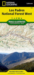
Los Padres National Forest contains a wide range of ecosystems, from seacoast and marine habitats to redwood forests, mixed conifer forests, oak woodlands, grasslands, pinyon juniper stands, chaparral and semi-desert areas, which are home to more than 486 fish and wildlife species. Explore this diverse and scenic region in detail with National Geographic’s Trails Illustrated map of Los Padres National Forest West. Created in partnership with local land management agencies, this expertly researched map highlights many key areas of interest including Gaviota State Park; Pismo, Refugio and El Capitan state beaches; Lake Cachuma; Chumash Painted Cave State Historic Park; Sisquoc Wild and Scenic River; Oceano Dunes State Vehicular Recreation Area; and Santa Margarita Lake Regional Park.
This map can guide you off the beaten path and back again with miles of mapped trails including trails for hiking and horseback riding, as well as ATV and motorcycle use. The San Marcos Pass Road and San Luis Obispo North Coast scenic byways are noted for those wishing to take in the scenery by car. Many recreation features are noted as well, including campgrounds, trailheads, OHV staging areas, horse camps, Frisbee golf, boat launches, and fishing, windsurfing, and swimming areas. The map base includes contour lines, shaded relief, and elevations for summits, passes, and many lakes.
Every Trails Illustrated map is printed on "Backcountry Tough" waterproof, tear-resistant paper. A full UTM grid is printed on the map to aid with GPS navigation.
Other features found on this map include: Arroyo Grande, Cuyama River, Garcia Wilderness, Goleta, Grover Beach, Irish Hills, La Panza Range, Lake Cachuma, Los Padres National Forest, Machesna Mountain Wilderness, Point San Luis, Purisima Hills, San Luis Obispo, San Luis Obispo Bay, San Rafael Mountains, San Rafael Wilderness, Santa Lucia Wilderness, Santa Margarita Lake, Sierra Madre Mountains, Sisquoc River, Timber Peak.
Map Scale = 1:80,000Sheet Size = 25.5" x 37.75"Folded Size = 4.25" x 9.2Informations détaillées sur le livre - Los Padres National Forest West National Geographic Maps Author
EAN (ISBN-13): 9781566955799
ISBN (ISBN-10): 1566955793
Date de parution: 2012
Editeur: National Geographic Maps Core >9
Livre dans la base de données depuis 2016-01-19T16:59:50+01:00 (Zurich)
Page de détail modifiée en dernier sur 2022-02-14T09:29:54+01:00 (Zurich)
ISBN/EAN: 9781566955799
ISBN - Autres types d'écriture:
1-56695-579-3, 978-1-56695-579-9
Autres types d'écriture et termes associés:
Auteur du livre: national geographic maps
Titre du livre: trails west national geographic, national geographic maps
Autres livres qui pourraient ressembler au livre recherché:
Dernier livre similaire:
9781566953474 Black Hills South [Black Hills National Forest] National Geographic Maps Author (Rand McNally)
< pour archiver...