
ISBN: 9781566953528
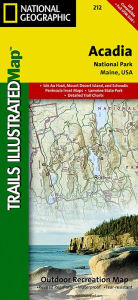
• Waterproof • Tear-Resistant • Topographic MapNational Geographic's Trails Illustrated map of Acadia National Park is designed to meet the needs of all visitors who wish t… Plus…
| BarnesandNoble.com new in stock. Frais d'envoizzgl. Versandkosten., Livraison non-comprise Details... |

ISBN: 9781566953528
This Trails Illustrated topographic map is the most comprehensive recreational map for Acadia National Park, located along the beautiful Atlantic coast in Maine. Updated to reflect road c… Plus…
| Orellfuessli.ch Nr. A1008396838. Frais d'envoiLieferzeiten außerhalb der Schweiz 3 bis 21 Werktage, , Versandfertig innert 1 - 2 Werktagen, zzgl. Versandkosten. (EUR 17.67) Details... |

ISBN: 9781566953528
This Trails Illustrated topographic map is the most comprehensive recreational map for Acadia National Park, located along the beautiful Atlantic coast in Maine. Updated to reflect road c… Plus…
| wordery.com Nr. 9781566953528. Frais d'envoi, , GB. (EUR 0.00) Details... |

ISBN: 9781566953528
Mount Desert Island, Sestern Mountain, Norwood Ridge, Freeman Ridge, Isle au Haut, Marshall Island, Swans Island, Western Bay, Mount Desert Narrows, Eastern May, Frenchman Bay, Eastern Wa… Plus…
| Buecher.de Nr. 26831363. Frais d'envoiKein Versand in Ihr Zielland., Livraison non-comprise Details... |

2012, ISBN: 9781566953528
Trails Illustrated National Parks, Karte/Globus, Karte (gefalzt), 2019th ed. [PU: National Geographic Maps], National Geographic Maps, 2012
| lehmanns.de Frais d'envoiVersand in 7-10 Tagen. (EUR 0.00) Details... |

ISBN: 9781566953528
• Waterproof • Tear-Resistant • Topographic MapNational Geographic's Trails Illustrated map of Acadia National Park is designed to meet the needs of all visitors who wish t… Plus…


ISBN: 9781566953528
This Trails Illustrated topographic map is the most comprehensive recreational map for Acadia National Park, located along the beautiful Atlantic coast in Maine. Updated to reflect road c… Plus…

ISBN: 9781566953528
This Trails Illustrated topographic map is the most comprehensive recreational map for Acadia National Park, located along the beautiful Atlantic coast in Maine. Updated to reflect road c… Plus…

ISBN: 9781566953528
Mount Desert Island, Sestern Mountain, Norwood Ridge, Freeman Ridge, Isle au Haut, Marshall Island, Swans Island, Western Bay, Mount Desert Narrows, Eastern May, Frenchman Bay, Eastern Wa… Plus…
2012, ISBN: 9781566953528
Trails Illustrated National Parks, Karte/Globus, Karte (gefalzt), 2019th ed. [PU: National Geographic Maps], National Geographic Maps, 2012
Données bibliographiques du meilleur livre correspondant
| Auteur: | |
| Titre: | |
| ISBN: |
Informations détaillées sur le livre - Acadia National Park National Geographic Maps Author
EAN (ISBN-13): 9781566953528
ISBN (ISBN-10): 1566953529
Version reliée
Date de parution: 2009
Editeur: National Geographic Maps Core >9
2 Pages
Poids: 0,091 kg
Langue: eng/Englisch
Livre dans la base de données depuis 2009-11-02T17:02:36+01:00 (Zurich)
Page de détail modifiée en dernier sur 2023-10-09T19:25:06+02:00 (Zurich)
ISBN/EAN: 9781566953528
ISBN - Autres types d'écriture:
1-56695-352-9, 978-1-56695-352-8
Autres types d'écriture et termes associés:
Auteur du livre: yes illustrated, mcnally rand, national geographic maps
Titre du livre: 212, acadia, park, usa nordosten, national geographic maps, national geographic map, national geographic englisch, trails
Données de l'éditeur
Titre: Acadia National Park, ME - National Geographic Trails Illustrated USA Nordosten
Editeur: National Geographic Maps
Langue: Anglais
9,99 € (DE)
10,30 € (AT)
Not available (reason unspecified)
CB; GEF; Karten, Globen / Reisen/Karten, Stadtpläne, Atlanten/Nordamerika, Mittelamerika; Landkarten und Atlanten; Nordamerika (USA und Kanada)
Autres livres qui pourraient ressembler au livre recherché:
Dernier livre similaire:
9780072345858 National Geographic Maps (Trails Illustrated)
< pour archiver...